Roswell Street from the Square to the Big Chicken and north to the parkway: ZIPs 30060 and 30062, mostly zoned to Sawyer Road Elementary, I-75 exit 265.
Last checked Oct. 5, 2026. Sources: the City of Marietta’s Roswell Streetscape Project page, its Envision Marietta LCI major update (PDF), parcel map data and parks map data, the state’s 2025 School Grades data, Zillow Research, CobbLinc schedule data and OpenStreetMap.
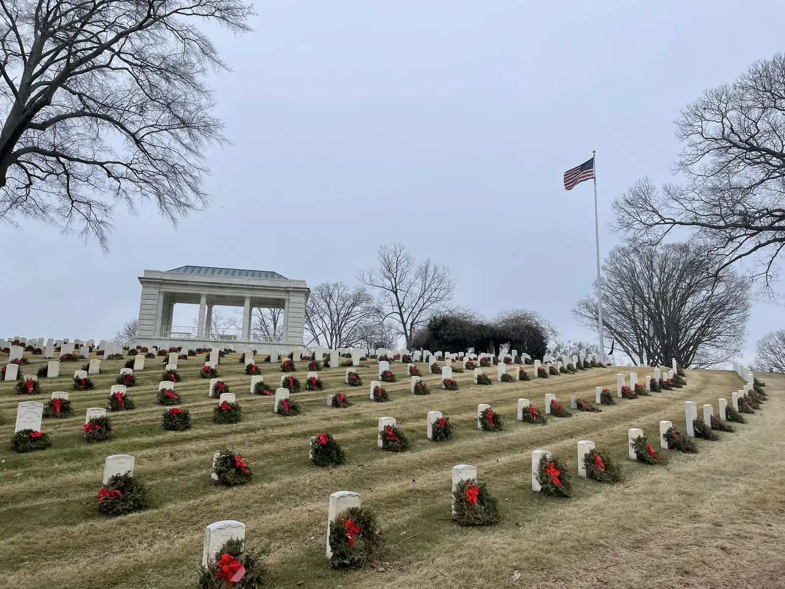
Roswell Street runs east from Marietta Square to Cobb Parkway at the Big Chicken, and on across I-75. This page covers the city between Roswell Street and North Marietta Parkway, east of the Lemon Street and Church-Cherokee areas and west of the interstate: residential streets, Custer Park’s sports complex and Marietta National Cemetery.
What this means for you
- Zoned high school: Marietta High, like every address in the city. Most of the area is zoned to Sawyer Road Elementary; check one address with the city’s property search tool.
- Home value: $344,408 typical value in ZIP 30060 in August 2026, according to the Zillow Home Value Index.
- Nearest I-75 exit: exit 265, North Marietta Parkway.
Part of our Marietta neighborhoods guide.
Where it is
The city’s 2019 Envision Marietta LCI update divides its study area into districts and names a Roswell Street District along this corridor. It groups Roswell Street with its Entertainment and Education districts as “key commercial gateway corridors ripe for redevelopment.” At the east end, it identifies a Big Chicken transit oriented development district “as a future mixed use, higher density development area” near the I-75 managed lanes.
The city’s Roswell Streetscape Project page calls Roswell Street “a main gateway into the city.” The project, partly paid for with Livable Centers Initiative funds, adds “wide brick sidewalks, street lighting, street trees and a few pocket parks,” and the city’s Board of Lights and Water is putting power lines underground along the street.
ZIP codes in the city’s parcel data: 30060 for 62% of parcels, 30062 for 30% and 30064 for 7%. The 30062 parcels are on the northeast side, toward I-75.
Schools
The area is inside the city, so it is served by Marietta City Schools. The share column is the share of parcels in this area zoned to each school in the city’s parcel data; the score is the school’s 2025 College and Career Ready Performance Index (CCRPI) from the state’s School Grades report.
| Level | School | Share of parcels | 2025 CCRPI |
|---|---|---|---|
| Elementary | Sawyer Road Elementary, 840 Sawyer Road (report card) | 61% | 83.2 |
| Elementary | Park Street Elementary, 105 Park St. SE (report card) | 18% | 65.7 |
| Elementary | A.L. Burruss Elementary, 325 Manning Road (report card) | 16% | 93.3 |
| Sixth grade | Marietta Sixth Grade Academy (report card) | All | 82.2 |
| Middle | Marietta Middle (report card) | All | 78.6 |
| High | Marietta High (report card) | All | 79.8 |
Another 4% of parcels are zoned to West Side Elementary. With four elementary zones meeting here, the zone lookup matters more than the street name. More in our schools guide.
Home values
From the Zillow Home Value Index for August 2026, a modeled typical value for the middle third of homes, not a sale price:
| ZIP code | Share of area parcels | Typical value, Aug. 2026 | Change from Aug. 2025 |
|---|---|---|---|
| 30060 | 62% | $344,408 | -1.43% |
| 30062 | 30% | $552,874 | -0.52% |
ZIP 30062 reaches far into east Cobb County outside the city, so its figure says little about the city blocks here. The citywide figure for Marietta was $471,117, down 1.17% on the year. More in our home prices guide.
Parks and trails
From the city’s parks map data:
- Custer Park Soccer Complex, 600 Kenneth E. Marcus Way, 7.93 acres, and Custer Park Sports and Fitness Center, 545 Kenneth E. Marcus Way.
- Birney Street Park, 475 Birney St., 1.47 acres.
- Barnes Mill Road Greenspace, 889 Barnes Mill Road.
- Marietta National Cemetery, 500 Washington Ave., 22.63 acres, on the area’s southwest side.
See our parks guide and kids activities guide.
Getting around
- I-75: exit 265, where North Marietta Parkway and Roswell Street (Georgia 120 Alternate) meet the interstate. Ramp signs in OpenStreetMap point drivers toward Marietta and Roswell.
- Downtown: about 1.5 miles by road from the middle of the area to the Square.
- Airport: Hartsfield-Jackson Atlanta International Airport is about 28 miles by road. Both figures are distances measured on the OpenStreetMap road network with the OSRM routing engine, not drive times.
- Buses: according to CobbLinc’s published schedule data, routes 15 and 40 stop on Roswell Street at Alexander Street, route 45 runs along Cobb Parkway at North Marietta Parkway and Seminole Drive, and route 50 stops on Roswell Street at Dodd Street and on Gresham Road. See CobbLinc’s routes page.
More in our getting around guide.
Groceries and everyday stores
OpenStreetMap lists no supermarket or pharmacy inside this area. The nearest it lists are just south of Roswell Street on Cobb Parkway South:
- Walmart Supercenter, 210 Cobb Parkway South
- ALDI, 249 Cobb Parkway South
How we drew this area
The area is the city parcels north of Roswell Street and south of the Elizabeth area, between the Lemon Street and Church-Cherokee areas and I-75. The Envision plan’s district maps are drawings, not parcel lines, so edges are approximate. School and ZIP shares count every parcel in that area in the city’s parcel data on Oct. 5, 2026. Store locations are © OpenStreetMap contributors.
Frequently asked questions
What elementary school serves the Roswell Street area of Marietta?
Sawyer Road Elementary is zoned for 61% of the area’s parcels in the city’s parcel data. Park Street serves 18%, A.L. Burruss 16% and West Side 4%. Every city address is zoned to Marietta High.
What ZIP codes are along Roswell Street in Marietta?
In the city’s parcel data, 62% of the area’s parcels are in 30060 and 30% are in 30062. Zillow put the typical home value at $344,408 in 30060 and $552,874 in 30062 in August 2026.
What is the Roswell Streetscape Project?
A city project, funded in part with Livable Centers Initiative money, that adds wide brick sidewalks, street lighting, street trees and pocket parks to Roswell Street, which the city calls a main gateway into Marietta. The city’s Board of Lights and Water is also putting power lines underground along the street.
What parks are near Roswell Street in Marietta?
Custer Park, with a soccer complex at 600 Kenneth E. Marcus Way and a sports and fitness center at 545 Kenneth E. Marcus Way, plus Birney Street Park at 475 Birney St., according to the city’s parks map data.
Have your say