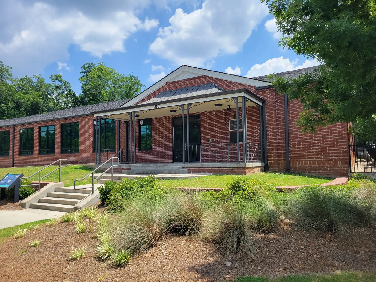
Lemon Street and the Washington Avenue historic district east of the Square: ZIP 30060, zoned to Burruss or West Side Elementary, I-75 exit 265.
Last checked Oct. 5, 2026. Sources: the City of Marietta’s Washington Avenue National Register nomination (PDF), its Envision Marietta LCI major update (PDF), parcel map data, neighborhoods map layer and parks map data, the state’s 2025 School Grades data, Zillow Research, CobbLinc schedule data and OpenStreetMap.
Lemon Street and Washington Avenue run east from the blocks around Marietta Square, between Roswell Street to the south and the Church-Cherokee area to the north. The western end is the Washington Avenue Historic District, which its federal nomination describes as “a residential area just east of the downtown square.”
What this means for you
- Zoned high school: Marietta High, like every address in the city. Elementary school is split between A.L. Burruss and West Side; check one address with the city’s property search tool.
- Home value: $344,408 typical value in ZIP 30060 in August 2026, according to the Zillow Home Value Index.
- Nearest I-75 exit: exit 265, North Marietta Parkway.
Part of our Marietta neighborhoods guide.
Where it is
The city’s neighborhoods map layer names the streets here Lemon, and a smaller neighborhood southeast of the Square Meeting Park. OpenStreetMap labels the area around Washington Avenue as the Washington Avenue Historic District.
The National Register nomination (PDF) covers about 11 acres. It says the district is “the intact portion of a historic residential area near downtown Marietta that developed from the 1830s through the 1930s,” with “Greek Revival, Queen Anne, Classical Revival, and simple Victorian styles,” and that many of its houses “have been rehabilitated for use as office space.”
The city’s 2019 Envision Marietta LCI update lists the Lemon Street School building among the study area’s landmarks. It says the building housed Lemon Street Elementary School, “an all-black school prior to the desegregation of schools,” which “closed its doors in 1971,” and that it is owned by Marietta City Schools. The plan’s placemaking section proposes historical markers, such as its Lemon Street plaque, to tell the stories of the city’s older neighborhoods.
In the city’s parcel data, 95% of parcels here are in ZIP code 30060.
Schools
The area is inside the city, so it is served by Marietta City Schools. The share column is the share of parcels in this area zoned to each school in the city’s parcel data; the score is the school’s 2025 College and Career Ready Performance Index (CCRPI) from the state’s School Grades report.
| Level | School | Share of parcels | 2025 CCRPI |
|---|---|---|---|
| Elementary | A.L. Burruss Elementary, 325 Manning Road (report card) | 59% | 93.3 |
| Elementary | West Side Elementary, 344 Polk St. NW (report card) | 41% | 91.8 |
| Sixth grade | Marietta Sixth Grade Academy (report card) | All | 82.2 |
| Middle | Marietta Middle (report card) | All | 78.6 |
| High | Marietta High (report card) | All | 79.8 |
Both zoned elementary schools are across town from Lemon Street: Burruss on Manning Road off Whitlock Avenue and West Side on Polk Street. The district’s Marietta Performance Learning Center is at 353-B Lemon St. More in our schools guide.
Home values
The typical home value in ZIP 30060 was $344,408 in August 2026, down 1.43% from $349,422 in August 2025, according to the Zillow Home Value Index. The index is a modeled typical value for the middle third of homes, not a sale price. ZIP 30060 covers much of the south and east side of the city, so the figure is not this area alone. The citywide figure for Marietta was $471,117, down 1.17% on the year. More in our home prices guide.
Parks and trails
From the city’s parks map data:
- Hugh L. Grogan Jr. Community Center, 510 Lawrence St., a city recreation center on 2 acres.
- Marietta National Cemetery, 500 Washington Ave., just east, on our Roswell Street page.
- Hill Park, 144 Lemon St., and Woods Park, 147 Haynes St., at the downtown end.
See our parks guide.
Getting around
- I-75: exit 265, North Marietta Parkway, the exit the city’s directions page gives for downtown.
- Downtown: about 0.6 mile by road from the middle of the area to the Square.
- Airport: Hartsfield-Jackson Atlanta International Airport is about 29 miles by road. Both figures are distances measured on the OpenStreetMap road network with the OSRM routing engine, not drive times.
- Buses: CobbLinc route 45 stops on Fairground Street at Lawrence Street and at Rigby Street, according to CobbLinc’s published schedule data. Routes 15 and 40 stop on Roswell Street a few blocks south. See CobbLinc’s routes page.
More in our getting around guide.
Groceries and everyday stores
OpenStreetMap lists no supermarket or pharmacy inside this area. The nearest it lists are:
- Walgreens, 23 S. Marietta Parkway, and CVS Pharmacy, 300 Powder Springs St., downtown
- Walmart Supercenter, 210 Cobb Parkway South, and ALDI, 249 Cobb Parkway South, to the southeast near the Big Chicken
How we drew this area
The area combines the Lemon and Meeting Park polygons in the city’s neighborhoods layer with the Washington Avenue National Register district. School and ZIP shares count every parcel in that area in the city’s parcel data on Oct. 5, 2026. Store locations are © OpenStreetMap contributors.
Frequently asked questions
What is the Washington Avenue Historic District in Marietta?
A National Register district of about 11 acres just east of Marietta Square. Its nomination says the area developed from the 1830s through the 1930s, with Greek Revival, Queen Anne, Classical Revival and simple Victorian houses, many now used as offices.
What elementary school serves Lemon Street in Marietta?
The area is split. In the city’s parcel data, 59% of parcels are zoned to A.L. Burruss Elementary and 41% to West Side Elementary. Every city address is zoned to Marietta High.
What ZIP code is Lemon Street in Marietta?
ZIP code 30060, for 95% of the area’s parcels. Zillow put the typical home value in 30060 at $344,408 in August 2026, down 1.43% in a year.
What was the Lemon Street School?
The city’s 2019 Envision Marietta plan says the building housed Lemon Street Elementary School, a school for Black students before desegregation, which closed in 1971. The plan says Marietta City Schools owns the building.
Have your say