Manget, Dixie Avenue and the Atlanta-Frasier Street district south of the Square: mostly ZIP 30060, mostly zoned to Park Street Elementary, I-75 exit 263.
Last checked Oct. 5, 2026. Sources: the City of Marietta’s Atlanta-Frasier Street National Register nomination (PDF), its Envision Marietta LCI major update (PDF), parcel map data, neighborhoods map layer and parks map data, the state’s 2025 School Grades data, Zillow Research, CobbLinc schedule data and OpenStreetMap.
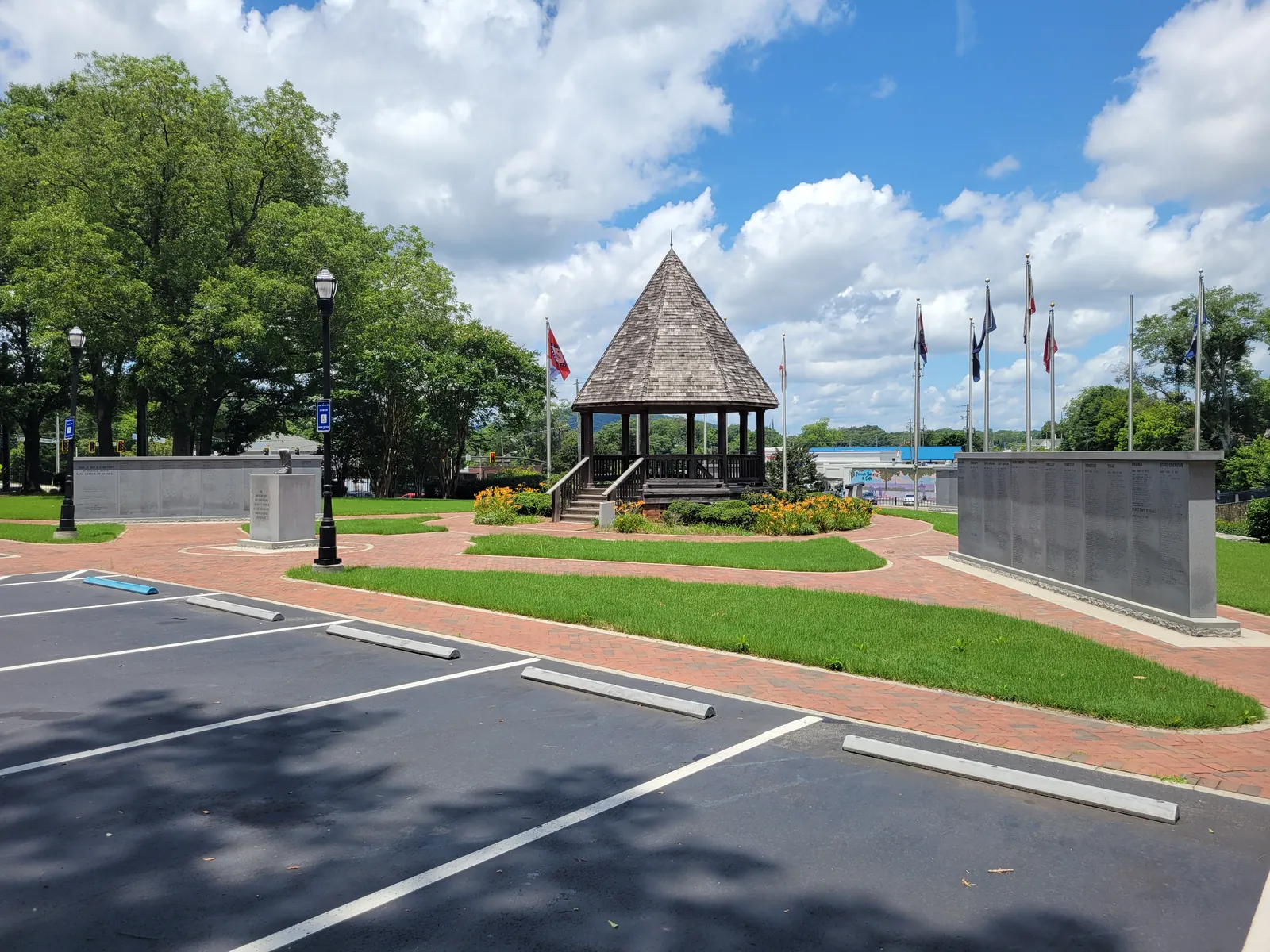
South of Marietta Square, between Powder Springs Street on the west and Fairground Street on the east, is a block of older residential streets that the city’s maps divide into Manget, Dixie/Atlanta and W. Dixie. Atlanta Street runs south from the Square through the area, crossing South Marietta Parkway, and two cemeteries listed in the city’s parks data sit on its western edge.
What this means for you
- Zoned high school: Marietta High, like every address in the city. Most of the area is zoned to Park Street Elementary; check one address with the city’s property search tool.
- Home value: $344,408 typical value in ZIP 30060 in August 2026, according to the Zillow Home Value Index.
- Nearest I-75 exit: exit 263, South Marietta Parkway (Georgia 120 Loop).
Part of our Marietta neighborhoods guide.
Where it is
The three names come from the city’s neighborhoods map layer. Inside them is the Atlanta-Frasier Street Historic District, which its National Register nomination (PDF) calls “a small historic residential area in the city of Marietta located a few blocks south of the central business district,” about 15 acres. Its houses run “from Greek Revival-style houses to late-19th-century Queen Anne and Folk Victorian styles to early 20th-century Colonial Revival and Craftsman-style houses.”
The city’s 2019 Envision Marietta LCI update names a Gramling district here, after Gramling Street, and groups it with the Victory/Aviation and Fairground Street districts as “historic residential communities where this study focuses on preserving and reinvesting in affordable housing.”
ZIP codes in the city’s parcel data: 30060 for 79% of parcels, 30008 for 16% and 30064 for 4%.
Schools
The area is inside the city, so it is served by Marietta City Schools. The share column is the share of parcels in this area zoned to each school in the city’s parcel data; the score is the school’s 2025 College and Career Ready Performance Index (CCRPI) from the state’s School Grades report.
| Level | School | Share of parcels | 2025 CCRPI |
|---|---|---|---|
| Elementary | Park Street Elementary, 105 Park St. SE (report card) | 82% | 65.7 |
| Elementary | Hickory Hills Elementary, 500 Redwood Drive SW (report card) | 18% | 77.6 |
| Sixth grade | Marietta Sixth Grade Academy (report card) | All | 82.2 |
| Middle | Marietta Middle (report card) | All | 78.6 |
| High | Marietta High (report card) | All | 79.8 |
The district’s elementary choice program lets families apply for a different elementary school Nov. 1 to 15, if there is room. More in our schools guide.
Home values
From the Zillow Home Value Index for August 2026, a modeled typical value for the middle third of homes, not a sale price:
| ZIP code | Share of area parcels | Typical value, Aug. 2026 | Change from Aug. 2025 |
|---|---|---|---|
| 30060 | 79% | $344,408 | -1.43% |
| 30008 | 16% | $327,811 | -1.87% |
Both ZIP codes cover much more than this area. The citywide figure for Marietta was $471,117, down 1.17% on the year. More in our home prices guide.
Parks and trails
From the city’s parks map data:
- Larry Ceminsky Park, 125 W. Dixie Ave., 3.19 acres.
- Kirby Park, 426 Frasier St., 2.77 acres.
- Ron H. Francis Park, 135 Gramling St., 0.7 acre.
- Perry Parham Park, 529 Manget St., just south of the area.
- Brown Park, 358 W. Atlanta St., just north toward the Square.
- Marietta City Cemetery, 395 Powder Springs St., 18.3 acres, and the Marietta Confederate Cemetery, 381 Powder Springs St., 6 acres, on the west edge.
See our parks guide and history and landmarks guide.
Getting around
- I-75: exit 263, South Marietta Parkway (Georgia 120 Loop). Ramp signs in OpenStreetMap point drivers from that exit toward Marietta and Kennesaw State’s Marietta campus.
- Downtown: about 0.9 mile by road from the middle of the area to the Square.
- Airport: Hartsfield-Jackson Atlanta International Airport is about 28 miles by road. Both figures are distances measured on the OpenStreetMap road network with the OSRM routing engine, not drive times.
- Buses: four CobbLinc routes stop here, according to CobbLinc’s published schedule data: routes 15, 40 and 45 on Fairground Street at Frasier Street and Pierce Street, route 30 on Atlanta Road at East Dixie Avenue and on Atlanta Street at Pearl Street, and route 15 on Powder Springs Street at West Dixie Avenue. The Marietta Transfer Center is about a mile east. See CobbLinc’s routes page.
More in our getting around guide.
Groceries and everyday stores
OpenStreetMap lists no supermarket or pharmacy inside this area. The nearest it lists are:
- CVS Pharmacy, 300 Powder Springs St., just north
- Walmart Supercenter, 210 Cobb Parkway South, and ALDI, 249 Cobb Parkway South, to the east near the Big Chicken
How we drew this area
The area combines the Manget, Dixie/Atlanta and W. Dixie polygons in the city’s neighborhoods layer with the Atlanta-Frasier Street National Register district. School and ZIP shares count every parcel in that area in the city’s parcel data on Oct. 5, 2026. Store locations are © OpenStreetMap contributors.
Frequently asked questions
Where is the Manget neighborhood in Marietta?
South of Marietta Square, around Manget Street, on both sides of South Marietta Parkway. The city’s neighborhoods map layer names it Manget, with Dixie/Atlanta and W. Dixie next to it.
What elementary school serves Manget and Atlanta Street?
Park Street Elementary is zoned for 82% of the area’s parcels in the city’s parcel data, and Hickory Hills Elementary for 18%. Every city address is zoned to Marietta High.
What ZIP code is the Manget area of Marietta?
Mostly 30060, with 79% of parcels; 16% are in 30008. Zillow put the typical home value at $344,408 in 30060 and $327,811 in 30008 in August 2026.
What is the Atlanta-Frasier Street Historic District?
A National Register district of about 15 acres a few blocks south of downtown Marietta. Its nomination says it developed from the mid-19th through the early 20th century, with houses from Greek Revival to Craftsman.
Have your say